Here are the Adventures from Aurangabad Division !

“Nothing adventured, nothing attained”- Peter Mcwilliams.
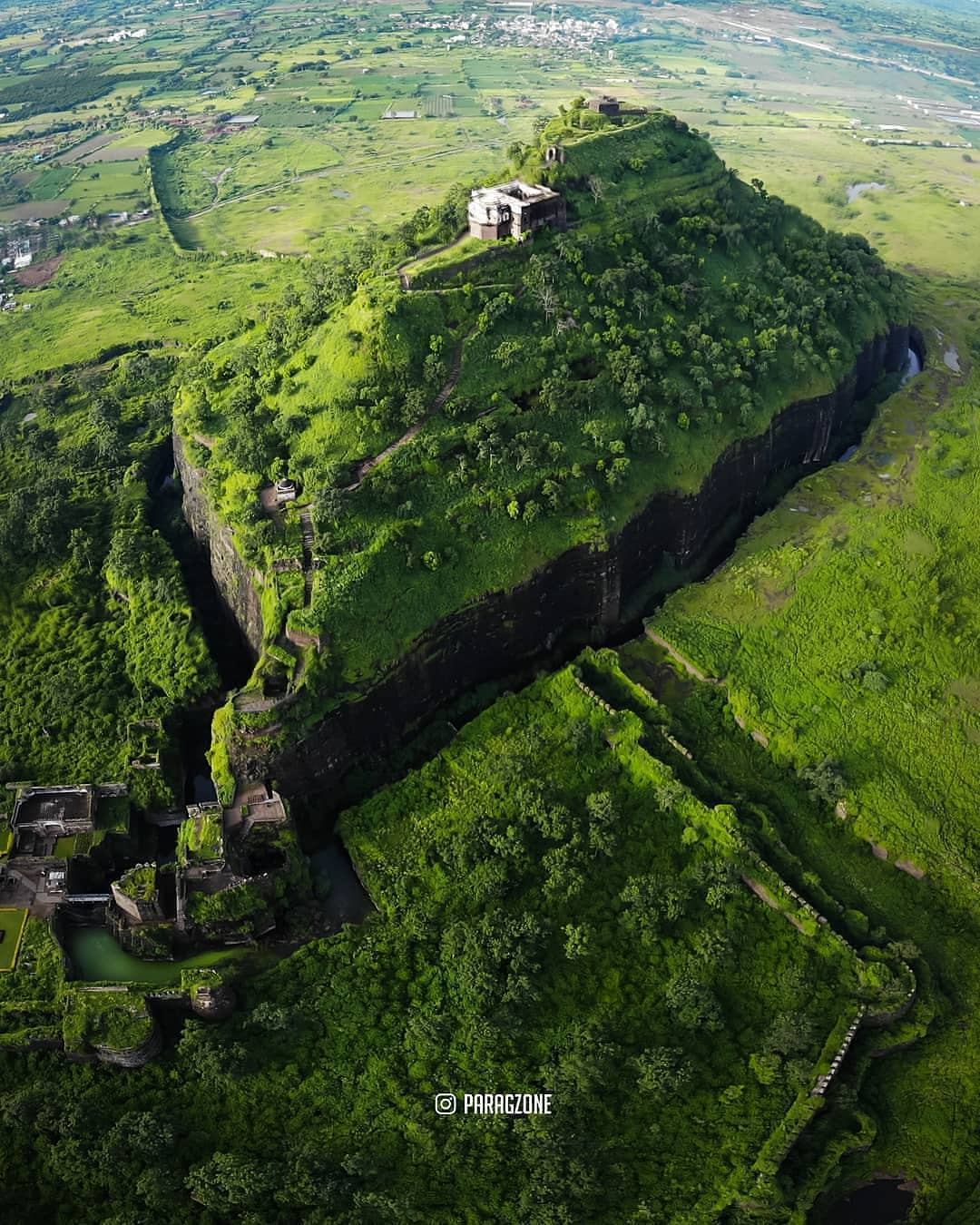
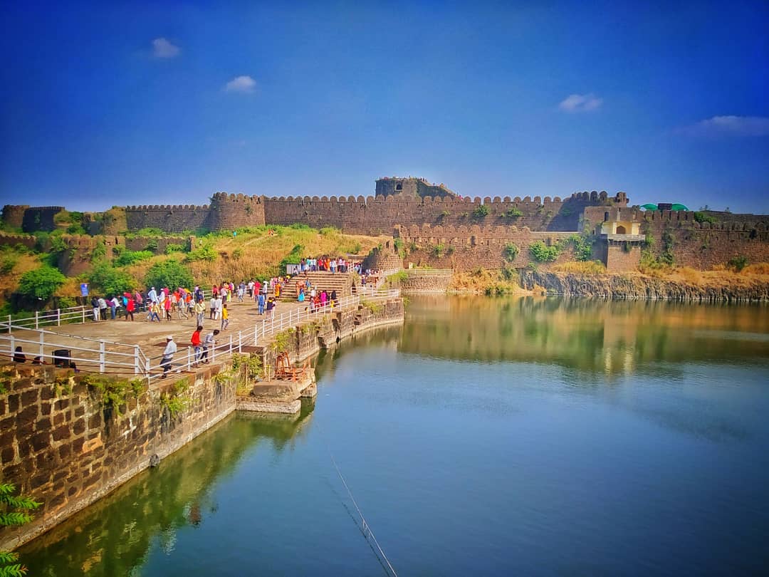
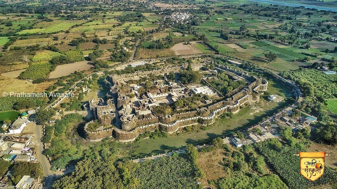
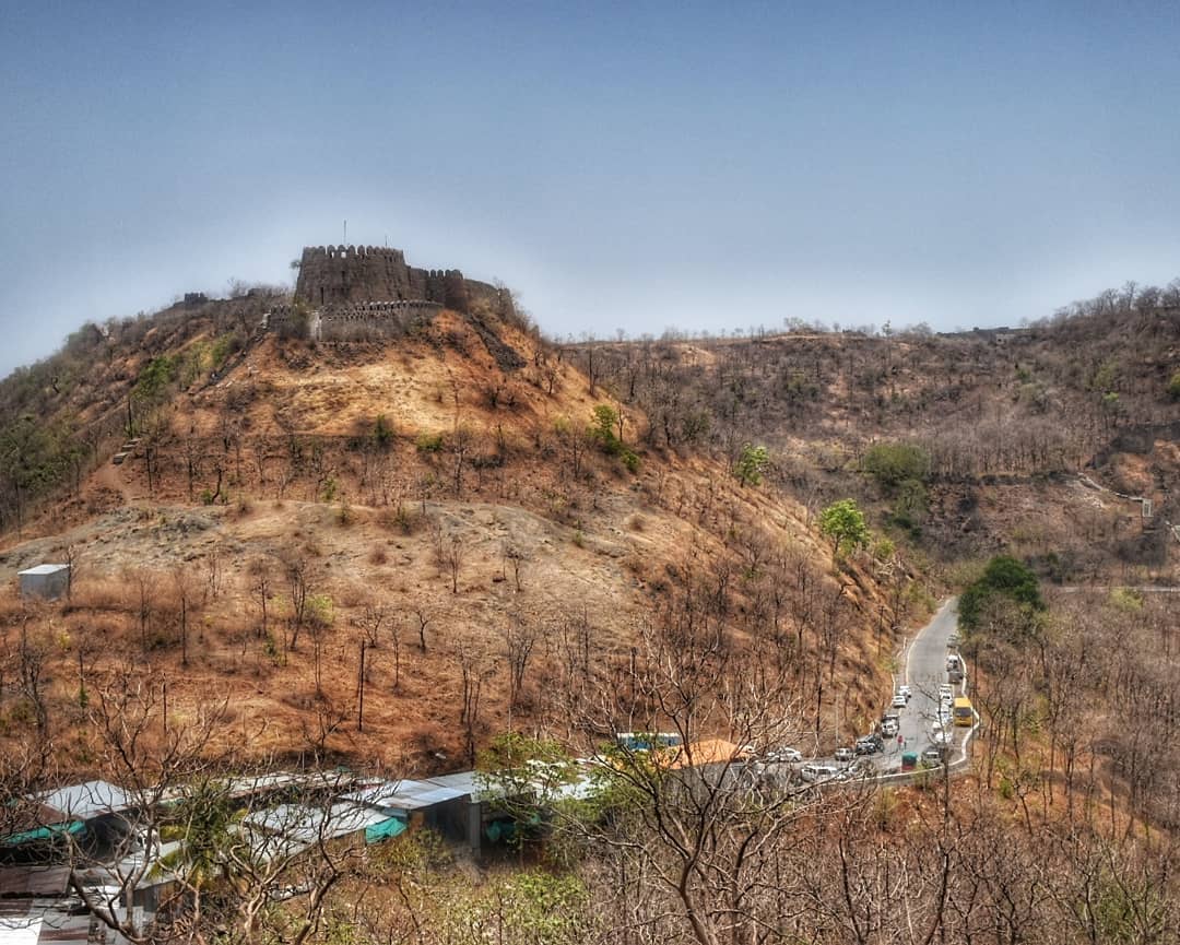
Located 15 km away from the main city of Aurangabad, Daulatabad Fort is an ancient fortification that rises formidably from the midst of verdant greenery. Often hailed as one of the 'seven wonders of Maharashtra', this architectural marvel is believed to have been built in the 12th century. Also known as Devgiri fort, perhaps the most enchanting qualities is its location, from the zenith of which you can capture a mesmerising view of the entire city. You need to hike some 750 odd steps up to the top, but the view down below is a wonderful thing to behold.
One of the most inspiring aspects of the Daulatabad Fort is its design which makes it one of the most powerful fortresses of the medieval period. It is built on a 200 metres high conical hill, which provides this grand fortress with a strategic position, architectural beauty and protection from the enemies. Another unique aspect of the mighty Devgiri Fort is its engineering genius, which not only provided an impregnable defence against enemy forces but also managed irreplaceable resources of water quite well. The contrast of the ancient edifice against the lush green fields of Aurangabad paints a wonderful picture that takes you back through the pages of the days bygone.
How to Reach Daulatabad FortDaulatabad fort is located 27 km away from Aurangabad. It takes approximately half an hour by buses or private vehicles from Aurangabad. State transport buses are frequent.
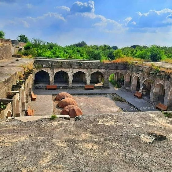
Tips to Trek Daulatabad FortAusa fort in Latur district is one such fort that has a blurred history of itself. Ausa Fort’s prominence came to light during the fights between the Deccan Sultanates after the Bahamani Era. The Fort had been named 13 different names, but the name Ausa was the last one that it is now known by. The fort is located in a depressed ground level, and the highest point of the fort looks over the surrounding higher ground level. The design seems to have been useful to watch out for incoming armies from a greater distance while keeping most of the fort hidden.
The Fort is designed in a nearly square form with a double rampart mounted with Turkish engineered cannons over semicircular bases, and the whole fort is in the centre with almost 120 feet wide ditches surrounding it. The Fort has seen numerous modifications from its original form thus unintendedly becoming a design collaboration of the Hindu and Muslim architecture over the years of its occupancy. Among the surviving Inscriptions that are mostly in an unreadable condition, one of the Nilgiri inscription dates to the year 1529. The Ausa Fort happens to have a patchy History that needs discovery.
By Air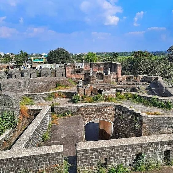
Udgir is famous for the historic battle between Marathas led by Sadashivrao Bhau and Nizam in 1759. Sadashivrao Bhau bravely defeated Nizam. The fort of Udgir is said to be built by the king of Bahamani. The fort is bounded by a 40 feet deep trench which is now overgrown with bushes. There are two main watch towers- one immediately at the entrance which overlooks the Udgir city. There is a huge canyon called Suryamookhi on this buruj. There are few remains of palaces next to this tower. The second floor had rooms which seemed like Seesh-Mahal... The other watch tower is at the far right end from where you can see Samadhi of Udaygir Maharaj below and the entire buildings in the fort. There are several palaces and Durbar halls. The fountain is worth dekko.The scence from the other end watch tower. The strength of this fort was in the double fortification. The Samadhi of Udaygir Maharaj is on the right hand side before you enter through second gate and is 60 feet under the normal ground level. It is believed that the Udgir fort has a direct deep underground soorang (tunnel) connection with Bhalki & Dharur Fort.
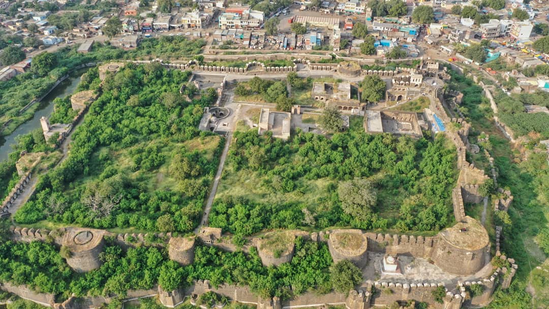
The Kandar Fort is a must see destination in the city as is popular for its architecture. This fort is located in the Kandhar town of Nanded district. Krishna III or Kandharpuradhi Swar, who ruled Malkhed constructed this fort in Nanded to secure his kingdom from the enemies. The fort has a moat with water encircling it and features a splendid look even though it is in ruins now.
Kandhar Fort is located at Kandhar city in Nanded district of Maharashtra state, India. Kandhar Town is famous for its fort. Fort is situated in the heart of Kandhar Town. Very few forts in Maharashtra are as well maintained as Kandhar. The fort is encircled with a ditch full of water.
Kandhar Fort construction is attributed to the Rashtrakuta King Krishna III of Malkhed who styled himself as Kandharpuradhi Swar. Outside the fort at some distance is a hillock on which is situated an old Idgah held in reverence by the Muslims. It is of Nizamshahi period with two domes in characteristic Ahmednagar style. The ruins of this majestic and historic fort are located at a distance of 50 km from the Ranthambhore Nationwide Park.
This majestic fort is built on two hills which do not meet. The whole structure flaunts a magnificent view which makes this place amongst the top destinations to visit in Nanded. The location has many temples like the Renuka Devi temple, Anusuya temple and Kalika temple near by. The fort is located very close to Mahur village and remains crowded during festive seasons.
The fort and the temple are accessible in all seasons. The nearest rail head is Kinwat which is 50 km from Mahur. The Mahur village is connected by motorable road. There are two trek routes to Mahurgad, starts from temple of Renukadevi located on the hillock south of village Mahur. It takes about 20 minutes to reach the fort entrance. There is also another route from Kinwat, but it passes through dense jungles. It takes another hour to visit the entire fort.
The fort was built by Yadavas of Devgiri. 1n 1358, the fort was under the rule of Muhamad Shah Bahamani. In 1398, a local Gond chief from Berar captured Mahur. In 1428, Ahmed Shah Bahamani won the Mahurgad. Burhan Nizam Shah of Ahmadnagar defeated Alauddin Imad Shah of Berar in 1527 and occupied Mahur. In 1617, the Mughal Emperor Shah Jahan defeated the Ahmednagar rulers and gained control of the Fort. Pandita Savitribai Deshmukh was the ruler of Varhad, who was holding the Jagir of Mahur during the Mughal Empire rule. She was given honorary name of Rai Bagan ( Royal tigress) (Marathi: रायबागन) by Mughal Emperor Aurangzeb after defeating Harchandrai. In 1670, Chatrapati Shivaji gained the control of Aurangabad and Berar. After the death of Shivaji, the Moghuls again gained the control of Berar in 1689. The six-month revenue during Moghul period was Rs 8,47,113. In 1724, Nizam-ul-mulk of Hyderabad defeated Alam Ali Khan and Dilavar Khan of Mughal Army in the Battle of Balapur. The Mahurgad remained under the control of Nizam of Hyderabad until the princely State of Hyderabad was annexed to Union of India in 1948.[
This fort is situated at just 4 kms away from the Railway Station of Nanded, which makes it a splendid location for those tourists who are on a one day trip. Godavari River covers the fort from all three sides. The splendid garden and water on the sides contributes to the natural beauty of the fort. After a walk across the various sections of this fort, you can relax in the fort's garden to enjoy some fresh air.
There are records of Nanda and Satavahana had ruled Nanded. Nanded was known as Nanditat from the records of copper plate found in Vashim (Vatsagulma). The fort is said to be built by Yadavas of Devgiri . in 1318 Nanded was captured by Muhammad bin Tugalak. 1n 1358, the fort was under the rule of Muhamad Shah Bahamani.In 1398 a local Gond chief from Berar captured Nanded and Mahur.In 1428 Ahmed Shah Bahamani won the Nanded and Mahurgad. Burhan Nizam Shah of Ahmadnagar defeated Alauddin Imad Shah of Berar in 1527.In 1602 a fierce battle took place at Nanded between Malik Ambar and Khan Khanan of Moghul in which he was defeted. In 1617 the Moghul Emperor ShahJahan defeated the Ahmednagar rulers and gain control of the Fort . In 1670 Chatrapati Shivaji gained the control of Aurangabad and Berar. After the death of Shivaji , the Moghuls again gained The six- monthly revenue during Moghul period was Rs 20,68,193. Nizam-ul-mulk of Hyderabad defeted Alam Ali Khan and Dilavar Khan in the Battle of Balapur. The Nanded remained under the control of Nizam of Hyderabad until the princely State of Hyderabad was annexed to Union of India in 1948.
How to reachThe fort is accessible in all seasons. It takes about 20 minutes to reach the fort entrance from the main city. There is also another route from Kinwat but, it passes through dense jungles. It takes another hour to visit the entire fort.
Type: Land Fort
Base Village: Paranda
Where:210 KMs from Pune
Route: Pune-Tembhurni-Kurduwadi-Parnda
Time visited: August 2011
Time to see around: 1 hour
How to visit:
Take a left turn from Tembhurni off Pune-Solapur highway towards Kurduwadi. From Kurduwadi take ‘Kurduwadi-Latur’ toll road. I took the Parnada turn from where Paranda was around 25 Kms. But the road was in horrible condition. Better enquire about this before you take a turn. The alternative is to precede towards Barshi and then ‘Barshi- Paranda’ road which in better condition. Meter reading from Pune: 268
Paranda Fort is situated in Paranda, a small town in osmanabad district in the state of Maharashtra,India.It is protected monument by Archaeological Survey Of India. The fort may have been constructed in the 15th century by Mahmud Gawan or by Murtaza Nizam Shah II in the early
Naldurg is one of the biggest Land forts of Maharashtra reflecting Indo- Islamic architectural style. The fort wall is supposedly 3 km long and has several bastions. Naldurg is named after a medieval king Nalaraja, built during the time of the Chalukyas of Kalyani. Later on, it has been passed or captured by many rulers from Bahamani sultanates to Adilshahi and then it went to the hands of Mughals. After the decline of Mughals, Nizams captured the fort and flourished in the region. It is also said that the infamous marriage of Chand bibi sultana occurred in the Rang Mahal of Naldurg fort. This wedding occurred between two kingdoms namely AdilShahi and NizamShahi.
Best Time to visit: During and After Monsoon is the best time to visit Naldurg fortHow to Reach:
By Road
35 km from Tuljapur, 50 km from Osmanabad, 50 km from Solapur.