
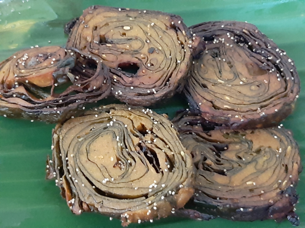
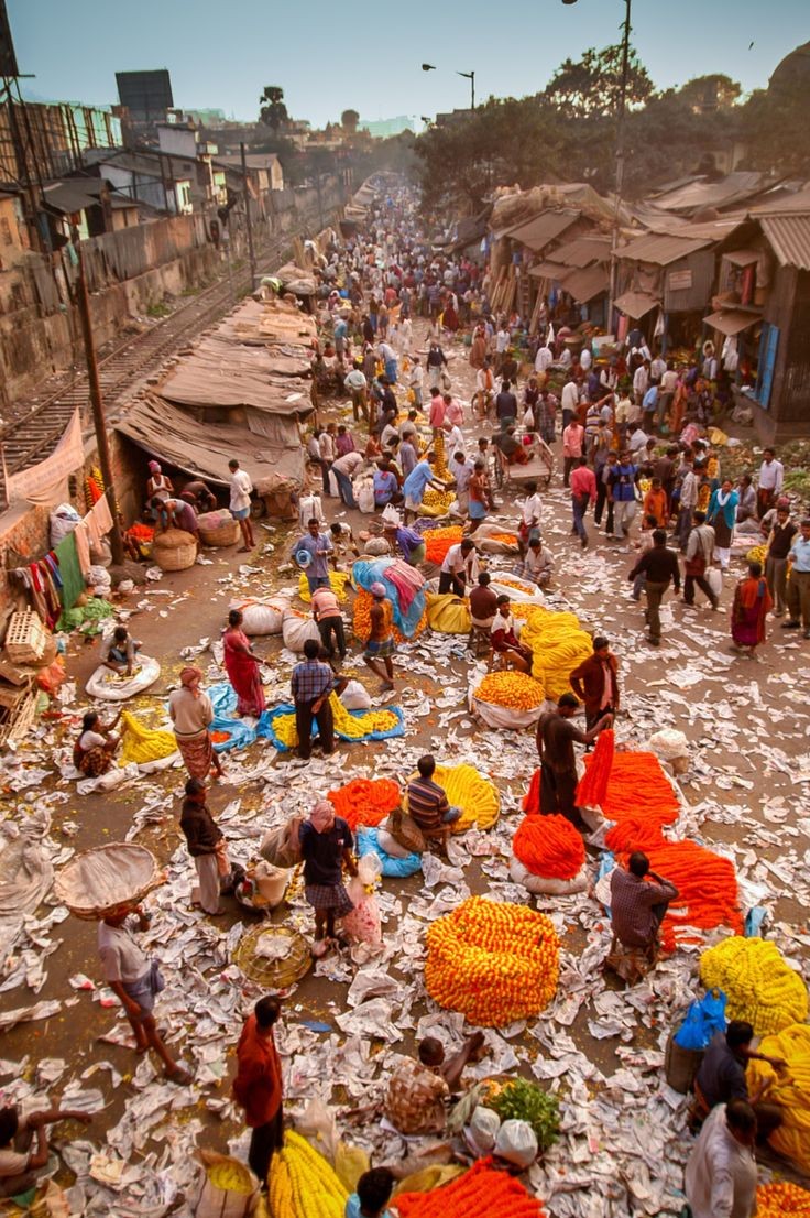
Alu wadi
In Ratnagiri there are two types of jackfruits, Kapa and Baraka. you can also try Phanas poli and fried gare.
"The Forest District of Maharashtra "
Gadchiroli district was carved out on the 26th of August 1982 by the division of erstwhile Chandrapur district. Earlier, it was a part of Chandrapur District and only two places namely Gadchiroli and Sironcha were tahsils of Chandrapur District before the formation of Gadchiroli District. Major Bamboo Trees Gadchiroli tahsil was created in 1905 by transfer of Zamindari Estate from Brahmapuri and Chandrapur tahsil. Gadchiroli district was created on August 26, 1982 by bifurcating the Chandrapur district in the place of Brahmapuri, which is part of the Vidarbha region of Maharashtra. ... In ancient times the region was ruled by the Rashtrakutas, the Chalukyas, the Yadavas of Deogiri and later the Gonds of Gadchiroli. In the 13th century Khandkya Ballal Shah founded Chandrapur. He shifted his capital from Sirpur to Chandrapur. Chandrapur subsequently came under Maratha rule. In 1853, Berar, of which Chandrapur (then called Chanda until 1964) was part, was ceded to the British East India Company. In 1854, Chandrapur became an independent district of Berar. In 1905, the British created the tehsil of Gadchiroli by transfer of Zamindari Estate from Chandrapur and Brahmapuri. It was part of the Central Provinces till 1956, when with the reorganisation of the states, Chandrapur was transferred to Bombay state. In 1960, when the new state of Maharashtra was created, Chandrapur became a district of the state. In 1982 Chandrapur was divided, with Gadchiroli becoming an independent district in the place of Brahmapuri. Gadchiroli district is situated on the North-Eastern side of Maharashtra State & district is situated on the North-Eastern side of Maharashtra State & have State borders of Telangana and Chhattisgarh. Naxalism is highly prevalent in Gadchiroli district and subsequently has been highlighted as part of the Red Corridor, used to describe areas in India that are plagued by Naxalites. They took the shelter in the dense forest & hills of this district.


The charpala wildlife sanctuary is located in the Gadchiroli district of Maharashtra. Spread over an area of approx. 140 km, it has thick forest growth with occasional stretches of grasslands. Markhanda and Pedigundam hills flank the sanctuary from north-east and south and the Pranhita River flows along its western boundary. Sanctuary is located on the bank of Confluence of Wardha and Wainganga rivers. During the monsoons, river water swells and enters sanctuary mainly through the numerous nallahs. Along with backwater variety of fish, prawns and turtles also enters the sanctuary. The sanctuary has conspicuous riparian ecosystem in which population of fish, prawns and turtles thrive. They also support rich aquatic life and avi-fauna and sites of natural beauty and tranquility.The sanctuary has rich floral diversity where various species of shrubs, climbers, grass and thick forest of teak tress are found. The sanctuary abounds with wildlife. Tigers, leopards, jungle cats, bears, Wild dogs, Deer, Sambars and many other animals inhabit the sanctuary.The Sanctuary is comes under the control of Chief Conservator of Forest and Field Director, Tadoba Andhari Tiger Reserve. The best time to visit the park is during and between the months of February and May.Chaprala village is located in Chaprala Wildlife Sanctuary which comes under Chamorshi tahsil of Gadchiroli district. It is 44 k.m. away from Gadchiroli district headquarter and 14 k,m, away from Chamorshi. State transport buses and private vehicles are available at Chamorshi to visit the place.
Lok Biradari Prakalp (LBP) is a social project of the Maharogi Sewa Samiti, Warora in Chadrapur district involving a hospital, a school and an animal orphanage.It was started on 23 December 1973, by the social worker Baba Amte for integrated development of Madia Gond. It is in village Hemalkasa of Bhamragad taluka in Gadchiroli District of Maharashtra state.The LBP project is located at a distance 160 k.m. from Gadchiroli district headquarter and 60 k.m. away from Allapalli. Dr. Prakash Amte and his wife Dr. Mandakini Amte, who serve as the Medical Director and Medical Officer at the project respectively, were awarded the 2008 Ramon Magsaysay Award for Community Leadership. Nearest Airport is Nagpur which is 350 km away. Nearest railway station is Ballarpur in Chadrapur District. The LBP project is located at a distance 160 k.m. from Gadchiroli district headquarter and 60 k.m. away from Allapalli. S.T. buses and private vehicles are available at Allapalli to visit the place.
is a social project of the Maharogi Sewa Samiti, Warora involving a hospital, a school and an animal orphanage.[1] It was started on 23 December 1973, by the social worker Baba Amte for integrated development of Madia Gond. It is in Hemalkasa, Bhamragad taluka in Gadchiroli District of Maharashtra, India. Dr. Prakash Amte and his wife Dr. Mandakini Amte, who serve as the medical director and medical officer at the project respectively, were awarded the 2008 Ramon Magsaysay Award for Community Leadership
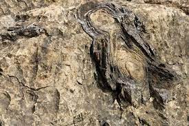
The Wadadam Fossil Park is situated nearby a village Wadadam in Sironcha taluka in Gadchiroli District of Maharashtra State. It is located 189 k.m. towards South from District head quarters Gadchiroli and 19 k.m. from Sironcha. A group of amateur archaeologists have unearthed fossils in the Maoist-hit Sironcha in Gadchiroli district of Maharashtra’s Vidarbha, which they claim date back millions of years and are believed to be of dinosaurs. Sironcha is among the five places in the country where dinosaur fossils have been found in large numbers. A full-fledged skeleton of a dinosaur was found in 1959 near the Godavari basin in Kothapalli-Pochampally village that borders Telangana. The fossil has since then been kept in a Kolkata museum.
Nearest Airport is Nagpur which is 380 km away. Nearest railway station is Chandrapur. The Wadadam Fossil Park is situated nearby a village Wadadam in Sironcha taluka in Gadchiroli District of Maharashtra State. It is located 189 k.m. towards South from District head quarters Gadchiroli and 19 k.m. from Sironcha. Buses and private vehicles are available from Sironcha to visit the place.

The Glory of Allapalli is situated in compartment no 76 in Allapalli Forest Range. It is about 16 k.m. from Allapalli on the way to Bhamragad. It is permanent preservation plot, which is maintained for the study of Allapalli forest under their natural condition. The plot has an area of 6 hector and it is established in the year 1953. The Various species of trees such as teak, tendu, dhawala, kusum, yen ect. are available in Van Vaibhav area. Also, medicinal plants such as gunj, tarota, gulwel are being found being here. Nearest Airport is Nagpur which is 306 km away. Nearest railway station is Chandrapur. It is situated at 16 k.m. from Allapalli and 116 k.m. from Gadchiroli. Buses and private vehicles are available at Allapalli in Aheri tahsil to visit the place. Allapalli is very famous for the forest. The Allapalli forests are the source of the world-famous teak wood (tectona grandis). The 'Glory of Allapalli' which represents the surviving patch of the original forests before they were brought under scientific management more than a 100 years ago, is famous as a living museum of the forest ecology. It is located 7 km. from Allapalli on the Permili-Bhamaragadh road. 2 divisional offices of the Forest Department are placed in Allapalli.
Markandadeo village is a popular place of God ‘Shiva’ and is grandeur for religious people not only in Maharashtra but also everywhere in India. It comes under Chamorshi Tahsil in Gadchiroli sub division. Village population is about 1000. The village is situated on the bank of Vainganga River.This temple complex is dedicated to Shiva. However, the Markanda name is derived from the Markandeya rishi of Haryana who was an ardent devotee of Shiva. He went into penance for years on the banks of Markanda river and finally tried to offer his head to Shiva when Shiva appeared and stopped him. He blessed him with a temple in his name.This temple complex is spread over 40 acres of land and many temples are in a dilapidated condition. The construction is attributed to the Rashtrakuta dynasty which there from the 8th to the 12th century. There are many intricate idols (murtis) on the outer walls of this temple complex.Markanda Mahadev can be reached while going from Chandrapur to Chamorshi, after the town Mul, before Chamorshi. Chandrapur to Markanda Mahadev is 67km. Nagpur to Markanda Mahadev temple complex is about 190km. Bussing is available at Chandrapur. The nearest railway station is Chandrapur, which is well connected to Nagpur, Hyderabad, Delhi, Chennai and Visakhapatnam. Near this temple a barrage is under construction named Chichdoh Barrage. It is near Sawali, Chandrapur.
The project is situated in Regdi village of Chamorshi tahsil. Under this project, water is used for farming purpose in near by villages. The place is very beautiful to visit here.he height of the dam above lowest foundation is 21.49 m (70.5 ft) while the length is 3,137 m (10,292 ft). The volume content is 957 km3 (230 cu mi) and gross storage capacity is 61,150.00 km3 (14,670.67 cu mi).Dina Dam, is an earthfill dam on the Dina river near Chamorshi, Gadchiroli district in the state of Maharashtra in India.
Official Designation of Dina Dam Irrigation Project is " Dina Dam , D - 01326 " . However local and popular name is " Dina Lake / DinaTalav ". Dina Dam was constructed as part of irrigation projects by Government of Maharashtra in the year 1974. It is built on and impounds Dina River . Nearest city to dam is Charmoshi in Gadchiroli District of Maharashtra . The dam is an Earth fill Dam .The Length of dam is 3137 m ( 10291.99 ft ) , while the Height of the dam above lowest foundation is 21.49 m ( 70.5052 feet ) . Project has a spillway of Ogee type.Length of the spillway is 122 m ( 400.262 feet ) The Dam has ungated Spillway.. Dam has a catchment area of 19.3 Thousand Hactors. Maximum / Gross storage capacity is 72.5 MCM. Live storage capacity is 67.54 MCM. Now a days almost all the water bodies make for good picnic spots. Dina Lake is also a popular Tourist attraction for its scenic beauty . Hilly Terrain and forest add further ti the beauty.
It is situated in Bhamragad Taluka. Binagunda-Kuokodi are historical villages. They find place in survey of India map. These are located in Abujmad, The tribe living in this area are called Bada Madias. It is a cluster of 6-7 villages with around 140 families. To reach the village Binagunda, we have to go to Aheri-Allapalli-Bhamragad-Laheri and then Binagunda-Kuokodi. The distance is about 210 km from headquarters Gadchiroli and also from Chandrapur. This cluster is almost cut off for 8 months. The BILT makes the road motorable for their purpose to extract and transport bamboos. The primitive tribes earn livelihood on the wages earned through bamboo cutting and the tendu patta collection. They used to do shifting cultivation. Their existence is mainly on forest. They are away and ignorant of the normal rural life of plain area. It is famous for it’s waterfall, INDRAS FALL. Binagunda is 40 kms east away from it’s Taluka place, Bhamragad. It is situated on the border of Maharashtra & Chattisgad states surrounded by hill vally of Abuzmad on the west. The fall crosses journey of 6 hills & falls at Binagunda throughout the year. 4 kms away Kuvvakodi is located on the hill top. Favourable Season for visit : Complete Year (Difficult to reach in Rainy season)

In Ratnagiri there are two types of jackfruits, Kapa and Baraka. you can also try Phanas poli and fried gare.
Besan is used more in vegetarian dishes in gadchiroli
Besan is used more in vegetarian dishes in gadchiroli
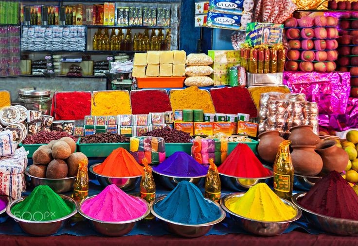
Vidarbha cuisine has influence of spices, dry coconut and besan (chickpea flour) thus making it a spicy cuisine.
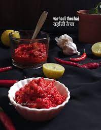
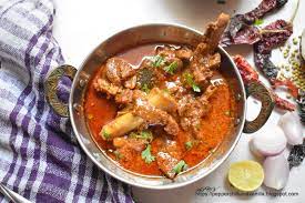
Varhadi Thecha constitute staple diet of the Vidarbha region.

Address: Ramnagar, Gadchiroli, Maharashtra 442605
Timing: 9am to 8pm.
Address: Chandrapur Rd, Ashirwad Nagar, Gadchiroli, Maharashtra 442605
Timing: 10am to 9pm.
Address: Kohamara- Wadsa - Gadchiroli - Saoli - Chandrapur Rd, Desaiganj, Maharashtra 441207
Timing: 9am to 9pm.
Address: Chamorshi Rd, Ashirwad Nagar, Gadchiroli, Maharashtra 442605
Timing: 8am to 10pm.
Address: Chamorshi Rd, Kannamwar Nagar, Gadchiroli, Maharashtra 442605
Timing: 9am to 9pm.
Address: NAVEGAON BRANCH, Murkhala, Gadchiroli, Maharashtra 442605
Timing: 10am to 8.30pm.

Chandrapur district (earlier known as Chanda district) is a district in the Nagpur Division in the Indian state of Maharashtra. Chandrapur was the largest district in India until the Gadchiroli and Sironcha tehsils were split into separate districts in 1981. In 2011, the district population was 2,204,307
From 1947 to 1956 the district of Bhandara along with the other districts of Vidarbha region continued to form a part of the central provinces.In 1956, Bhandara district was transferred from Madhya Pradesh to the Bombay State. In 1960,with the formation of the state of Maharashtra it becamed a part of State.
Gondia district lies at lattitudes 20.39 and 21.38 North and longitudes 79.27 to 80.42 east. The adjoining districts to Gondia are on northen side Balaghat district of Madhya Pradesh and on eastern sideRajnandgaon district of Chattisgarh state. To the south and west are Chandrapur district and Bhandara district of Maharashtra.