
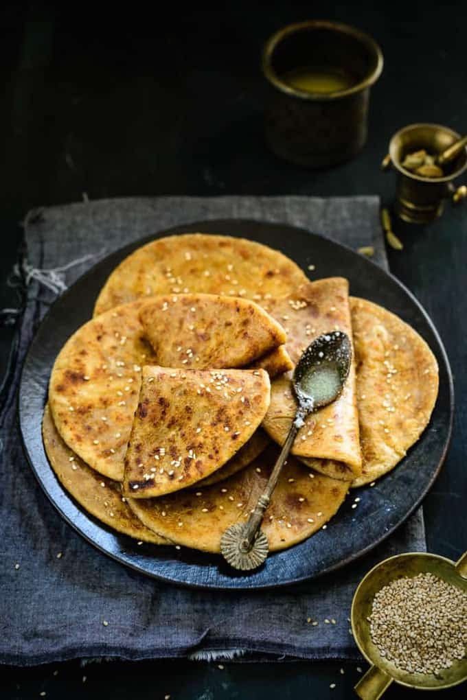
Gurmai
Gurmai is sweet chapati made by roti, jaggery and ghee.
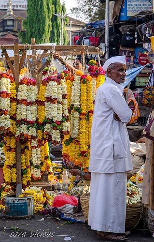
" Beautiful land of Khandesh ! "
The Old East Khandesh is the district Dhule today. This district is situated at the foot of the Satpuda hill. The mountain range of Sahyadri has reached the western side of this district. Besides, the mountains of Galna situated. Tapi, Panzara, Kan, Arunavati, Amravati, Aner, Evil and Sandy rivers flow through the district. The division of Dhule district on 1st July 1998 resulted in the existence of Nandurbar District. Dhule, Sakri, Shindkheda and Shirpur are among the four talukas in Dhule district. Dhule and Shirpur are administrative subdivisions.... From Dhule district, Mumbai-Agra, Nagpur-Surat, Dhule-Solapur national highways gone. While there is a railway service between Dhule and Chalisgaon, Bhusaval-Surat railway line is located in Dhule district. Near Dhule city, there is a special attention, at Nardana, Tal. Shindkheda There is industrial estate. There is an airport at Gondur, Tal./Dist.- Dhule and Shirpur.


Laling Fort or Laling Kila as it is popularly referred to in the regional dialect, Marathi, is a fortified military outpost alternating as a watchpost that was constructed in the early 12th century by Faruqi dynasty. The fortification takes its name from the summit of the hill on which it stands erected, Laling Hill. The Laling Fort has found mention many times in many travelogues and documented information with regards to the whereabouts of the grand Mughal horde's during the Deccan expeditions as early as the seventeenth century. In documented evidence the stronghold is revealed to be stronghold with whatever limited fortifications left in 1862.
Laling Fort or Laling Kila as it is popularly referred to in the regional dialect, Marathi, is a fortified military outpost alternating as a watchpost that was constructed in the early 12th century by Faruqi dynasty. The fortification takes its name from the summit of the hill on which it stands erected, Laling Hill. The Laling Fort has found mention many times in many travelogues and documented information with regards to the whereabouts of the grand Mughal horde's during the Deccan expeditions as early as the seventeenth century. In documented evidence the stronghold is revealed to be stronghold with whatever limited fortifications left in 1862.


After seeing the Lalling forts, Dhule is a village on the Mumbai-Agra highway, on the north side of the 19 km away Songir village. Songir village near by a suvarngiri or songir fort. It is built in a very important place. It is 304 meters high above sea level. From 1370, Fort consists of an old well and a reservoir alongside the ruins of an old water system. Dhule is recognized for its Songir Fort, constructed in the year 1820, and contains an inscription of Ugrasen, son of Raja Mansingh presenting the bravery of Ugrasen at its entrance gate.
This fort is located on a small hill. The entrance of the fort is in complete ruins with only the mainframe left. This gate had an inscription dated ‘Shake’ 1497 (1575 A.D.) stating that ‘Ugrasen, son of Man Singh was very brave’. This inscription is now with the local government authority. One can see remnants of pillars alongside the entrance. There are steps opposite the entrance leading upwards and a water tank just beneath.


Bhamer is well known for its underground caves which are known as Gavali Raja's House. These caves are located in the escarpments of the hills with some are honeycombed, some of them are plain and shapeless, but others are regular buildings with pillar-supported roofs.
Bhamer, however, is known for its fort known after the village name and more so for the caves or rather monk’s dwellings that are in the escarpments of the hills above the village. The fort located at the cast end of a rugged irregular range of rocky hills is divided from the rest of the range by an artificial chasm. The natural escarpment of the fort that overlooks the village has been strengthened in places by masonry constructions. Though the hill is of a considerable height, the ascent is easy and roundabout. On the southern face is the entrance leading into the fort. Inside are several cisterns of good water as also four large store rooms hollowed out of the rock. There are many ruined gateways and gates and nearly ruined towers. Time has also withered away the artificial fortifications at many places. It is supposed that the town was destroyed while punishing Kale Khan, a Muslim rebel, who had seized it in 1736. It never regained its original glory.
At distance of 48 kilometers from Dhule city and 13 kilometers from Sakri the fort of Bhamer is situated. There is a famous place of pilgrimage of Jain devotees at a distance of 27 kilometers from this fort. Here too, many Jain devotees from all over the country come to visit. In this temple Lord Vimalnath has a black stone statue.


Constructed in 1128 as per records, the Thalner fort is as much a historical marvel as it is a tourist attraction and has seen many change of hands in ownership during its longevity and as a token of tribute to this fact holds many Muhammedan tombs in its premises. Thalner is a fortified town close to Dhule city in Maharashtra and is home to many military outposts, the Thalner Fort being of primary significance amongst them due to its strategic location and massive stature. At the foot of this fort which lies at the summit of a small hill, lies an ancient and prehistoric stone temple dedicated to the deity Thaleshwar after whom the city of Thalner and its main military fort, take name. Thalner is a scenic location on the banks of the Tapi River, the fort built on an elevation to overlook the riverfront from a height. It was the stronghold of Faruqi kings and once a significant hub of trade and commerce during the peak of its glory.
The Thalner fort was a brilliant piece of architectural and shrewd military marvel. While it was surrounded by a hollow embanked moat on 3 sides, the fort wall rose from the Tapi River, thereby giving inhabitants safety from attack on 3 sides and the river always open for emergency exit. The only entrance is made available on the eastern side after traversing 5 gates all held together by a genius mechanism whose enclosure would rise up to the height of the main wall.
The Thalner fort is open all days, yet tourist are advised to visit there in daylight time due to the difficult terrain.


Rajwade Sanshodhan Mandal in Dhule is a famous museum established in 1932. There are many historical articles of the Mughal and Rajput period. In which, there are colored pictures, coins, historical copper plates, stone and metal statues, old hand written historical documents, stone apparatuses, pots etc. pre-historical articles, historical apparatuses and art gallery on history-related subjects.
Shri Vishvanath Kashinath Rajwade the great historian of Maharasthra died on 31st December 1926, leaving behind a good collection of Sanskrit and Marathi. Manuscripts numbering about 3500 and also a collection of historical documents and papers. The Mandal was established on 9th January 1927 at Dhulia with the object of erecting a fire proof building to house the late Shri. Rajwade’s collection for a safe keep and making it available to scholars and students working in the field of history, sociology and literature. The object of contributing fire proof building was achieved on 5th January 1932, when the building of Rajwade Sanshodhan Mandal was opened. The Mandal is interested in carrying out research work and publication. Soon the mandal published “ Dhatu Kosh “ and “ Namadi Shabda Vyutpati Kosh.” The Mandal runs a journal ‘Sanshodhak’ through which much of the writing of the late Rajwade have been published.
The Mandal maintains of modest Museum containing copper plates, coins, acroliths miniatures, painting, fine manuscript. Besides there is a picture gallery exhibiting large portraits of many historical personages a well as research scholars.


The sanctuary is situated on southwestern range of Satpura range in Shirpur Tehsil of Dhule District It shares boundaries with Yawal sanctuary other sanctuaries in Madhya Pradesh
While driving down the Bombay-Agra National Highway, you can easily visit the sanctuary where the animal world will invite you with warmth. Located in the southwest foothills of the Satpura range is the store house of lush green vegetation, with popular trees and grasses like Babul, Bel, Palas, Khair, Hiwar, Kusal, Bhuri, Casia auriculata, Albizzia lebbek and Dhawda.
These trees are the homeland for various fowls and during the dawn and dusk, the ambience fills up with the cheerful chirpings of the birds.


Gurmai is sweet chapati made by roti, jaggery and ghee.
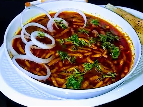
In jalgaon, famous local sabji here is shev bhaji it is gravy like liquid. Little bit spicy.
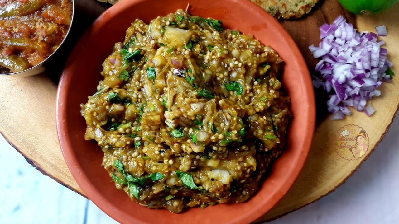
Another famous dish is Baigan Bharit it is made of big green brinjal.
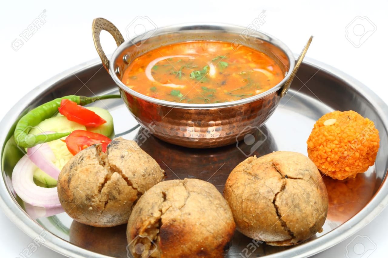
Dal Baati is an indian dish of dal (lentils) and baati(hard wheat rolls)
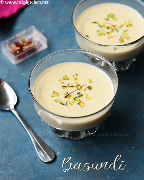
It is sweetend condensed milk made by boiling water on low heat. In North India, a similar dish goes by Rabri.

Ice crem is a sweetened frozen food typically eaten as a snack in desert.

Address: 1285, Agra Rd, Dhule, Maharashtra 424001
Timing: 24*7
Address: Parola Rd, Dhule 424001
Timing: 10am to 9pm.
Address:Old Agra Rd, Molviganj, Dhule, Maharashtra 424001
Timing: 11am to 9pm.
Address: 36, Garud S.T.Colony, Nakane Rd, Jai Santoshi Mata Colony, Dhule, Maharashtra 424002
Timing: Open at 9:30 am
Address: Sakri Rd, Dhule, Maharashtra 424001.
Timing: 9am to 9pm.
Address: Navjeevan Nagar, Chitod Rd, Dhule, Maharashtra 424001
Timing: 10am to 8.30pm.

Jalgaon is a district in the northern part of Maharashtra, India. The administrative seat is the city of Jalgaon.
Nandurbar is an administrative district in the northwest corner of (Khandesh region) of Maharashtra. On 1 July 1998 Dhule was bifurcated as two separate districts now known as Dhule and Nandurbar. The district headquarters is located at Nandurbar city.
Nashik is also known as Mini Maharashtra, because the climate and soil conditions of Surgana, Peth, Igatpuri resembles with Konkan. Niphad, Sinnar, Dindori, Baglan blocks are like Western Maharashtra and Yeola, Nandgaon, Chandwad blocks are like Vidarbha Region.